File:Terrain merge 20080320.jpg
From OpenSimulator
Size of this preview: 600 × 600 pixels.
Full resolution (800 × 800 pixels, file size: 48 KB, MIME type: image/jpeg)
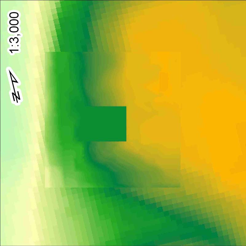
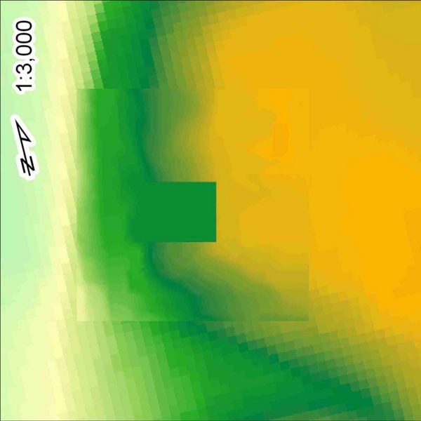
Not strictly a screen shot, this image represents the initial merge of site terrain at OpenSim-standard 1-meter grid postings, on top of 10-meter terrain commonly available for US sites from the US Geological Survey. The coarse 10-meter terrain makes unsightly stair-steps in an OpenSim region. A blog posting at http://blog.simgis.com/2008/03/ describes one approach to overcoming this, and thus making a great deal of public terrain data usable inside OpenSim regions intended to model real-world sites.
File history
Click on a date/time to view the file as it appeared at that time.
| Date/Time | Thumbnail | Dimensions | User | Comment | |
|---|---|---|---|---|---|
| current | 23:56, 26 March 2008 | | 800 × 800 (48 KB) | Darb (Talk | contribs) | Not strictly a screen shot, this image represents the initial merge of site terrain at OpenSim-standard 1-meter grid postings, on top of 10-meter terrain commonly available for US sites from the US Geological Survey. The coarse 10-meter terrain makes uns |
- Edit this file using an external application (See the setup instructions for more information)
File usage
There are no pages that link to this file.
