File list
From OpenSimulator
This special page shows all uploaded files.
| Name | Thumbnail | Size | User | Description | Versions | |
|---|---|---|---|---|---|---|
| 15:42, 3 March 2008 | Maze island.jpg (file) |  | 23 KB | Green | 1 | |
| 15:43, 3 March 2008 | Shirt island.jpg (file) |  | 17 KB | Green | 1 | |
| 15:44, 3 March 2008 | Opensimulator island.jpg (file) |  | 21 KB | Green | 1 | |
| 03:33, 6 March 2008 | News.png (file) |  | 4 KB | Phrearch | 1 | |
| 04:01, 6 March 2008 | Gettinghelp.png (file) |  | 3 KB | Phrearch | 1 | |
| 04:27, 6 March 2008 | Forward.png (file) |  | 4 KB | Phrearch | 1 | |
| 13:34, 7 March 2008 | OGS1Login Sequence.jpg (file) | 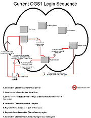 | 152 KB | Teravus | (Diagram of the Login Sequence with Summary) | 1 |
| 17:08, 7 March 2008 | Proposed IM Flow.jpg (file) | 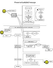 | 134 KB | Teravus | (Flow overview of the Instant Message/Presence Service) | 1 |
| 17:16, 7 March 2008 | Presence and the challenges it presents.jpg (file) |  | 140 KB | Teravus | (Another note of IM Challenge) | 1 |
| 21:37, 7 March 2008 | Wood02.jpg (file) |  | 294 KB | Trevas | 1 | |
| 21:49, 7 March 2008 | Brick02.jpg (file) |  | 379 KB | Trevas | 1 | |
| 22:01, 7 March 2008 | Roof1.jpg (file) |  | 220 KB | Trevas | 1 | |
| 10:59, 14 March 2008 | BugStates.png (file) |  | 73 KB | SeanDague | 1 | |
| 12:36, 17 March 2008 | Dynamictexture.png (file) | 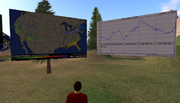 | 369 KB | SeanDague | 1 | |
| 10:44, 20 March 2008 | Home.png (file) |  | 3 KB | Phrearch | 1 | |
| 10:46, 20 March 2008 | Media.png (file) |  | 4 KB | Phrearch | 1 | |
| 22:52, 26 March 2008 | Terrain 20080323a.jpg (file) | 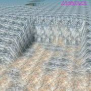 | 172 KB | Darb | (Detail of a university campus construction site represented in OpenSim, based on a precise model derived from 3D CAD site grading plan. This plan was merged with regional data by defining a projection-based local grid system to represent the grid used by) | 1 |
| 22:56, 26 March 2008 | Terrain merge 20080320.jpg (file) | 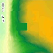 | 48 KB | Darb | (Not strictly a screen shot, this image represents the initial merge of site terrain at OpenSim-standard 1-meter grid postings, on top of 10-meter terrain commonly available for US sites from the US Geological Survey. The coarse 10-meter terrain makes uns) | 1 |
| 23:01, 26 March 2008 | Terrain vu Ely at Wly.jpg (file) | 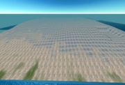 | 119 KB | Darb | (This is an easterly view from along the westerly limit of the campus-wide terrain model. The new site excavation is visible on the right, and was available at better than 1-meter resolution from precise CAD drawings. The main campus area in mid-view and) | 1 |
| 00:12, 9 April 2008 | Bamboo Texture6.jpg (file) |  | 2 KB | Kara Dae | 1 | |
| 12:10, 9 April 2008 | AIAI-2008-03-04-Opensim-AIAI-Sunset.jpg (file) | 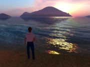 | 92 KB | Aiaustin | (AIAI Grid - Open Vue - Sunset) | 1 |
| 12:11, 9 April 2008 | AIAI-2008-02-05-Opensim-Expt 002.jpg (file) |  | 64 KB | Aiaustin | (AIAI - Open Vue - Media Streaming - Virtual World of Whisky) | 1 |
| 12:16, 9 April 2008 | AIAI-2008-03-08-Terrain-Scotland.jpg (file) |  | 64 KB | Aiaustin | (AIAI - Open Vue - Scotland Terrain) | 1 |
| 12:17, 9 April 2008 | AIAI-2008-02-05-Media-Streaming.jpg (file) | 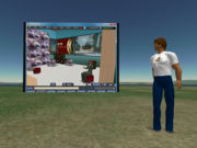 | 70 KB | Aiaustin | (AIAI - Open Vue - Media Streaming) | 1 |
| 12:24, 9 April 2008 | AIAI-2008-02-25-Iroom.jpg (file) | 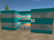 | 59 KB | Aiaustin | (AIAI - Open Vue - I-Room) | 1 |
| 23:35, 17 April 2008 | Svn054 4272.jpg (file) | 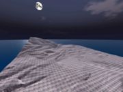 | 141 KB | Darb | (40-region sim on this evening's trunk - UC Berkeley at (1.024 : 1) in X and Y) | 1 |
| 23:38, 17 April 2008 | Svn054 4272 20080417.jpg (file) | 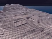 | 178 KB | Darb | (Windlight SL client viewing 40-region UC Berkeley 1.024 : 1 scale sim by moonlight ) | 1 |
| 23:39, 17 April 2008 | Svn054 4272 20080417a.jpg (file) | 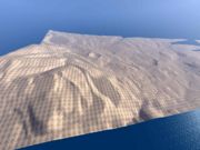 | 162 KB | Darb | (Windlight SL client viewing 40-region UC Berkeley 1.024 : 1 scale sim view toward LBNL ) | 1 |
| 08:18, 20 April 2008 | 2cg home 003 001.jpg (file) | 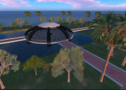 | 72 KB | MrCentralGrid | (Central Grid Orientation) | 1 |
| 08:19, 20 April 2008 | 2cg home 003 014.jpg (file) | 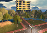 | 94 KB | MrCentralGrid | 1 | |
| 23:43, 23 April 2008 | Oscms architecture.jpg (file) | 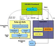 | 107 KB | Phrearch | 1 | |
| 08:56, 25 April 2008 | Lego1.png (file) | 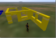 | 147 KB | Grumly | 1 | |
| 08:57, 25 April 2008 | Lego2.png (file) | 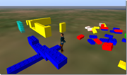 | 157 KB | Grumly | 1 | |
| 08:57, 25 April 2008 | Lego3.jpg (file) | 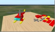 | 37 KB | Grumly | 1 | |
| 23:59, 28 April 2008 | Ob40 20080428a.jpg (file) | 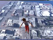 | 229 KB | Darb | (OpenSim 40-region model with four terrain megaprim sculpties/region for 13-cm orthoimagery) | 1 |
| 00:02, 29 April 2008 | Ob40 20080428b.jpg (file) | 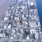 | 197 KB | Darb | (40-region OpenSim model with real-life aerial photography at 1.024:1 scale downtown Berkeley, CA) | 1 |
| 00:03, 29 April 2008 | Ob40 20080428c.jpg (file) | 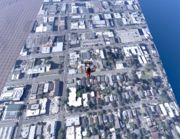 | 218 KB | Darb | (Real-life model 1.024:1 scale, of UC Berkeley environs. Natural true-scale terrain and orthoimagery) | 1 |
| 00:05, 29 April 2008 | Ob40 20080428d.jpg (file) | 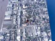 | 226 KB | Darb | (Yet another shot of current status: real-life megaprim sculptie terrain with 13-cm orthoimagery, all at 1.024:1 scale horizontally, 1:1 vertically. Imagery from 1 July 2006) | 1 |
| 01:31, 11 May 2008 | Nebadon2025 01.jpg (file) |  | 487 KB | Nebadon | 1 | |
| 01:33, 11 May 2008 | Nebadon2025 02.jpg (file) |  | 402 KB | Nebadon | 1 | |
| 01:34, 11 May 2008 | Nebadon2025 03.jpg (file) |  | 461 KB | Nebadon | 1 | |
| 01:34, 11 May 2008 | Nebadon2025 04.jpg (file) |  | 760 KB | Nebadon | 1 | |
| 01:35, 11 May 2008 | Nebadon2025 05.jpg (file) |  | 502 KB | Nebadon | 1 | |
| 01:35, 11 May 2008 | Nebadon2025 06.jpg (file) |  | 506 KB | Nebadon | 1 | |
| 01:36, 11 May 2008 | Nebadon2025 07.jpg (file) |  | 847 KB | Nebadon | 1 | |
| 01:36, 11 May 2008 | Nebadon2025 08.jpg (file) |  | 610 KB | Nebadon | 1 | |
| 01:37, 11 May 2008 | Nebadon2025 09.jpg (file) |  | 544 KB | Nebadon | 1 | |
| 01:38, 11 May 2008 | Nebadon2025 10.jpg (file) |  | 607 KB | Nebadon | 1 | |
| 01:38, 11 May 2008 | Nebadon2025 11.jpg (file) |  | 625 KB | Nebadon | 1 | |
| 01:38, 11 May 2008 | Nebadon2025 12.jpg (file) |  | 602 KB | Nebadon | 1 |
 First page |
 Previous page |
 Next page |
 Last page |
