File:Kentfield 20071029.jpg
From OpenSimulator
No higher resolution available.
Kentfield_20071029.jpg (600 × 300 pixels, file size: 74 KB, MIME type: image/jpeg)
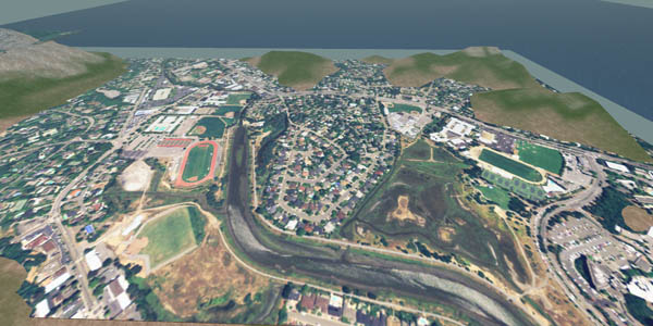
View northerly of Kentfield and Greenbrae, California. Orthoimagery source: National Agricultural Imagery Program (2005) 1-meter natural color. Terrain Source NGA/USGS 2-meter model (2003). The NAIP imagery is textured onto a 256m square prim.
File history
Click on a date/time to view the file as it appeared at that time.
| Date/Time | Thumbnail | Dimensions | User | Comment | |
|---|---|---|---|---|---|
| current | 00:05, 30 October 2007 | | 600 × 300 (74 KB) | Darb (Talk | contribs) | View northerly of Kentfield and Greenbrae, California. Orthoimagery source: National Agricultural Imagery Program (2005) 1-meter natural color. Terrain Source NGA/USGS 2-meter model (2003). The NAIP imagery is textured onto a 256m square prim. |
- Edit this file using an external application (See the setup instructions for more information)
File usage
The following 2 pages link to this file:
